Street-Level Data
360° Street Survey
Systematically collected 360° street-level imagery of the Shreveport–Bossier City metro area — georeferenced, parcel-matched, and processed into structured data products for institutional buyers.
Coverage Area
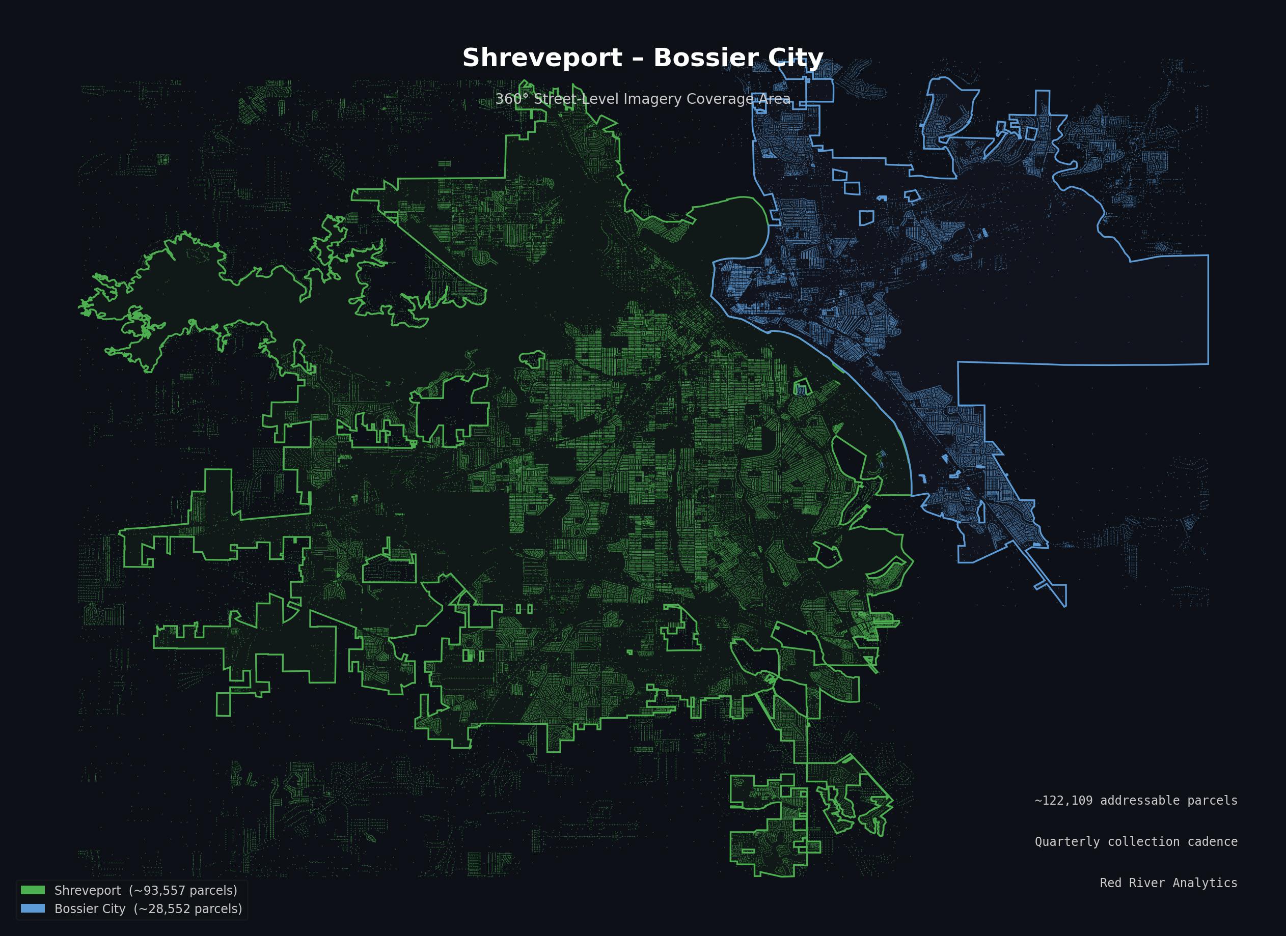
Shreveport city limits and Bossier City city limits. Residential street network, parcel-matched.
Available Products
Street-Level Imagery License
Georeferenced 360° frames, GPS track, and parcel association metadata — delivered as a licensed dataset. Each frame carries a precise timestamp, GPS coordinate, and heading; the parcel match table links frames to assessor parcel IDs. Suitable for property condition baseline, storm damage assessment, underwriting support, and infrastructure documentation.
Parcel Condition Scores
Computer vision–derived exterior condition scores for each surveyed parcel across six dimensions: roof, siding, windows and doors, lot condition, structural integrity, and tree hazard. Delivered as a scored flat file — one row per parcel — with composite exterior condition and interior-signal scores on a 0–100 scale and per-dimension rationale text.
Parcel Imagery Dataset
The parcel-matched image set: primary facade crop per parcel, blurred for faces and license plates, with associated condition metadata and GPS provenance. Designed for buyers who require the source imagery alongside or instead of derived scores — for integration into internal inspection workflows, claims systems, or proprietary models.
Request a sample dataset or ask about coverage, licensing, and delivery format.